
Ann Arbor likely to see 2 storm systems today; derecho possible, forecasters say
Two storm systems are expected to move through the Ann Arbor area today, bringing with them the potential for severe winds, hail and flooding.
The National Weather Service issued a severe thunderstorm watch today for several counties, including Washtenaw. The watch is in effect until 3 p.m.
This morning's storm system - now making its way into the area - is tracking in the form of a squall line, the weather service said. It should make its way through the region by 1 p.m.
At 11:12 a.m., Doppler radar showed strong thunderstorms along a line east extending from seven miles northeast of Marlette to 33 miles southwest of Adrian, moving east at 45 mph, the weather service said.
The storms so far have the potential for winds greater than 35 mph, occasional ground lightning, and brief heavy downpours, the weather service said.
Forecasters say it's too hard to predict yet whether the later storm - expected to be the more severe of the two - could result in a derecho, a widespread and long lived windstorm associated with a band of rapidly moving showers or thunderstorms.
Meteorologist Amos Dodson of the National Weather Service at White Lake Township said at 6:35 a.m. that a derecho is still possible.
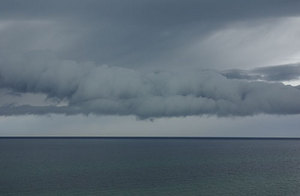
Forecasters are predicting two storm systems in the Ann Arbor area today.
"We haven't been able to nail that down yet," he said. "We'll just have to wait and see."
The second storm system is expected to also bring strong winds, possible hail and heavy rain, Dodson said. The latest estimate as of 10:30 a.m. pegged the time of that storm at between 4 p.m. and 6 p.m.
"Flooding is certainly a possibility because we're expecting heavy rainfall," he said.
In addition to storms, today's forecast calls for dangerously high temperatures. With temps in the low 90s, the heat index could reach 100 degrees in Washtenaw County, officials said.
By 11 a.m., the temperature had reached 76 degrees.
Comments
Ryan J. Stanton
Thu, Jun 24, 2010 : 1:02 p.m.
How to pronounce derecho: http://www.forvo.com/word/derecho/
steven
Wed, Jun 23, 2010 : 7:11 p.m.
Please help if you know the answer to this i have to pick up my girlfriend at the detroit airport, her flight arrives at 1030pm i just want to make sure i can get there, ill sit there with her if we have to wait out the storm, i am just wondering what time i should leave in order to not get stuck on I-90
julieswhimsies
Wed, Jun 23, 2010 : 4:26 p.m.
I didn't sign up for this wretched heat and humidity when I moved to Michigan.
Speechless
Wed, Jun 23, 2010 : 1:18 p.m.
Upcoming summertime film blockbuster: Derecho! Next summer's simmering sequel:  Izquierda!
5c0++ H4d13y
Wed, Jun 23, 2010 : 11:54 a.m.
I'm happiest when I'm learning new things.
JSA
Wed, Jun 23, 2010 : 11:28 a.m.
It's just another word used by pretentious individuals in much the paradigm is used. A term not needed when there are better simpler ways to describe the same thing. Academics tend to use it and similar terms because it inflates their egos.
huh7891
Wed, Jun 23, 2010 : 11:10 a.m.
derecho.. learn a new word and wear it out. Reminds me of a local news station weatherman years ago that used " Alberta Clipper" over and over until it was worn out.
Alan Benard
Wed, Jun 23, 2010 : 10:42 a.m.
New word bad! Make fun! Feel better now! Culture of ignorance, on display.
Smiley
Wed, Jun 23, 2010 : 10:04 a.m.
I AM EL DERECHO! PHUUUUUUUU!!! To the right, to the right, to the left, to the left...
Barb
Wed, Jun 23, 2010 : 9:50 a.m.
@Susan, it's an amusing word because it's fun to say. I think it goes without saying that if you read the headline and/or article, you know the storm is something to take seriously. Heaven forbid people should find humor in serious situations. Lighten up.
Tom Teague
Wed, Jun 23, 2010 : 9:49 a.m.
Lifted from the NOAA site (the link in the article): "The word "derecho" was coined by Dr. Gustavus Hinrichs, a physics professor at the University of Iowa, in a paper published in the American Meteorological Journal in 1888." I looked at the rest of the site, and the first real use of the word appears to be from 1969, though. If you're worried about foreign terms creeping into the weather reports, note that "tornado" is a word derived from Spanish as well, and it probably sounded funny to people who were accustomed to using the word "cyclone" (Dorothy's Auntie Em, for example).
mr54
Wed, Jun 23, 2010 : 9:49 a.m.
I don't recall saying or anyone mentioning it being an amusing word. Common sense tells you to take precautions in the event these storms hit. Oh i forgot common sense isn't too common these days
Top Cat
Wed, Jun 23, 2010 : 9:46 a.m.
Is a derecho the little green critter on the GEICO commercials?
RuralMom
Wed, Jun 23, 2010 : 9:42 a.m.
http://www.spc.noaa.gov/misc/AbtDerechos/derechofacts.htm
Sooze
Wed, Jun 23, 2010 : 9:39 a.m.
Yes its an amusing word (because it's new to you) but the strong winds aren't amusing--big trees come down. Stay alert and keep track of the weather so you can take cover if necessary.
81wolverine
Wed, Jun 23, 2010 : 9:35 a.m.
I'm not sure how it will get into the 90's today with it so cloudy, but we'll see if the sun comes out. Looks like the first storm is about an hour away now (10:35). Time to batten down the hatches I guess.
mr54
Wed, Jun 23, 2010 : 9:33 a.m.
Leave it to someone from AA to use a word like derecho.
hardworkingteacher
Wed, Jun 23, 2010 : 9:30 a.m.
I agree with jeanarrett. This must be the first time in at least 25 years that Michigan has a derecho because I have never heard this word in my life.
Barb
Wed, Jun 23, 2010 : 9:12 a.m.
@loser, a dorito? a delorean? Pass! Pass!
a2tom
Wed, Jun 23, 2010 : 9:10 a.m.
Derecho is actually derived from the Mayan word for bean dip.
loser
Wed, Jun 23, 2010 : 9:06 a.m.
ok...for $500 bob......a *blank* is a widespread and long lived windstorm that is associated with a band of rapidly moving showers or thunderstorms.
PittsfieldTwp
Wed, Jun 23, 2010 : 9:01 a.m.
Derecho or not. We are likely to get drench'ohed for sure. [rim shot]
Forever27
Wed, Jun 23, 2010 : 8:51 a.m.
Hello summer weather.
jeanarrett
Wed, Jun 23, 2010 : 8:48 a.m.
I said the same thing--somebody at AA.com just learned a new word. They used it in two different stories.
Brian Kuehn
Wed, Jun 23, 2010 : 8:01 a.m.
Somewhere out there we have a happy meteorologist. He or she finally got to use the word "derecho."
Kara Gavin
Wed, Jun 23, 2010 : 6:52 a.m.
A severe thunderstorm watch was issued at 7:43 a.m. - http://www.weather.com/weather/alerts/localalerts/48109?phenomena=SV&significance=A&areaid=MIC161&office=KDTX&etn=0394