
Cold front could bring severe storms, hail to Ann Arbor area
The Ann Arbor area could be in for some severe weather Wednesday afternoon, the National Weather Service says.
There’s a 50 percent chance of thunderstorms Wednesday afternoon and Wednesday night, and the National Weather Service said storms that do occur would likely be strong to possibly severe.
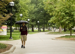
An umbrella may come in handy the next few days as showers and thunderstorms are expected in the Ann Arbor area. Here, University of Michigan senior Ryan Dougherty takes cover under one on a recent day on the Diag.
Daniel Brenner | AnnArbor.com
A cold front approaching from the west is bringing the potential for severe weather and will result in cooler temperatures for the next several days.
Showers and thunderstorms are likely Wednesday night, mainly before midnight, the weather service said. It will be mostly cloudy, with a low around 64.
Thursday, the chance of showers and thunderstorms will linger before 9 a.m. It will be partly sunny, with a high near 81. The chance of precipitation is 40 percent, the weather service said.
Friday will bring a chance for more rain, mainly after noon. The weather service forecasts partly sunny conditions with a high near 77. Rain is likely Friday night with a low around 58.
It’s also likely to rain on the Michigan football game Saturday. The weather service says there’s a 60 percent chance for rain Saturday, when the Wolverines take on Air Force. It will be mostly cloudy with a high near 66.
For updated forecast and conditions any time, visit AnnArbor.com's weather page.
Cindy Heflin is associate news director for AnnArbor.com. Contact her at cindyheflin@annarbor.com or 734-623-2572 or follow her on Twitter.
Comments
jns131
Wed, Sep 5, 2012 : 9:47 p.m.
Anything but another day of 90 plus heat and humidity. This has been one hot summer and I am so ready for that cold front. My plants can't wait either. Bring on the colder temps. I am done with summer.
brian
Wed, Sep 5, 2012 : 7:30 p.m.
Yeah, I have heard that before.
G-Man
Wed, Sep 5, 2012 : 7:21 p.m.
Or not........
applehazar
Wed, Sep 5, 2012 : 7:13 p.m.
Another new roof!
xmo
Wed, Sep 5, 2012 : 6:28 p.m.
"It's also likely to rain on the Michigan football game Saturday." Come on this is MICHIGAN!
Tom Todd
Wed, Sep 5, 2012 : 5:45 p.m.
What is Rain?
YpsiGreen
Thu, Sep 6, 2012 : 1:20 a.m.
Is this a rhetorical, philosophical, or hypothetical question?
jns131
Wed, Sep 5, 2012 : 9:48 p.m.
I heard it is something that makes one wet. Like a shower. Not sure.
Hmm
Wed, Sep 5, 2012 : 3:50 p.m.
Please let there not be hail my car cant take anymore pings and dings