
New segment of Washtenaw County border-to-border trail opens
Another stretch of a roughly 35-mile trail winding from the eastern end of Washtenaw County to its western edge is ready for public use.
The Friends of the Border-to-Border Trail is inviting the public to walk the newest segment this Saturday. It starts near Water Street and Michigan Avenue in Ypsilanti and follows along the northern shore of the Huron River for nearly a mile.
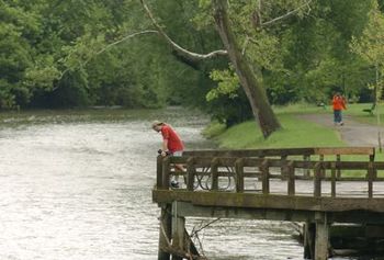
This file photo from 2007 shows the Huron River in Ypsilanti's Riverside Park, which runs along the river between Cross Street and Michigan Avenue.
File photo
“It’s really a nice area,” said Bob Krzewinski, director of Friends of the Border-to-Border Trail. “You wouldn’t even hardly be able to tell you are in a city.”
A path has existed in the area for years, but Krzewinski said it fell into disrepair. The group, along with the Washtenaw County Parks Commission, is working lay woodchips on the stretch, along with benches and signage.
“The county is doing really good work,” Krzewinski said. “Things are progressing fairly well. It takes a long time to build a good trail, and this is all part of the process.”
The border-to-border trail effort is now more than a decade old and was part of a 10-year, 0.25-mill park improvement millage passed by voters in 1998.
The Water Street corridor is the latest in several chunks of the trail that are already complete. Among the most heavily traversed parts are trails in areas like Ann Arbor’s Gallup Park, and residents can now travel a stretch of trail between Eastern Michigan University and downtown Ann Arbor.
In addition, the western part of the county has seen the opening of trails in Hudson Mills Metropark, Dexter and Dexter Township.
Ultimately, Krzewinski and others working on the project envision a path where bicyclists, joggers, walkers can use a unique recreation outlet or even a nonmotorized path to commute to work.
Krzewinski said woodchips along the Water Street segment are temporary until a concrete path can be installed. The Friends of the Border-to-Border Trail is holding events like Saturday’s walk and fundraisers to push for the project’s completion.
“We hope to have a really good walkable trail with woodchips markers, maps and all that by late spring,” he said. “The main thing we want to do right now is spread the word about the trail.”
The group holds walks monthly and organizes a large New Year’s Day walk annually.
Those interested in exploring the new segment of the trail can gather on Dec. 5 at 1 p.m. at Bombadill’s Cafe in downtown Ypsilanti or at 12:30 p.m. outside the Shadow Art Fair at the Corner Brewery on Forest Avenue. The walk will take approximately an hour.
• Download a copy of the border-to-border map, courtesy of the Washtenaw County Parks and Recreation Department, or click here for more information.
Tom Perkins is a freelance writer for AnnArbor.com. Reach the news desk at news@annarbor.com or 734-623-2530.
Comments
Cyclezealot
Fri, Dec 4, 2009 : 1:41 p.m.
Mr. Scooter Dog.. about plowing roads and bike trails.. Likely such transportation infrastructure projects as the trail project are appropriated by Federal Transportation funds, long time ago in the making.. Today's budget problems are a separate issue caused by the national budget crisis.. Local transportation maintenance are not national issues when the cause of the current fiscal problems are local in nature... the Federal/state Highway budget sets aside a certain amount of money for projects such as the trail project, funded long before the current budget crisis came to be..
Cyclezealot
Fri, Dec 4, 2009 : 1:31 p.m.
Wonder if the whole 35 miles will be bike friendly. Be nice if the eastern and western portion connect as one entire circle ride...
CycloChemist
Tue, Dec 1, 2009 : 10:33 p.m.
Great to see a story about the community coming together to rehabilitate what was once a beautiful park area, but has lately fallen into disrepair. Looking at the map, there is one name that is repeated over and over on this landscape - Ford Lake, Ford Heritage Park, Ford Road, Ford Blvd. I think, in time, Ypsilanti may be able to celebrate its close relationship with Ford. Has anyone contacted this powerful family to see if they'd be interested in doing some social good by underwriting some of the cost of trail development in this area? Perhaps Rep. Dingle would have the right connections and know-how to bring some Ford Money into Ypsilanti. Henry Ford, like most early automobile guys, cut his teeth (literally... that is, gear teeth) on bicycle mechanics. Maybe it's time for the Fords to bury the hatchet on car versus bike and make a statement that there is a place for both forms of transportation.
Bob Krzewinski
Tue, Dec 1, 2009 : 8:36 p.m.
On Border To Border Trail maps, there are two print maps currently available. One is the "City of Ann Arbor and Washtenaw County" bicycle map. This is available in quite a few bicycle shops around Ann Arbor, as well as the Ann Arbor City Hall. This map shows the B to B route through Ann Arbor. A second map is the "Border To Border Trail Map - Ypsilanti Area" which shows the B to B through Ypsi and Ypsilanti Township. This map is available at the Ypsi City Hall and also Ypsilanti Cycle in downtown Ypsi. Both maps can also be picked up at the Washtenaw County Parks and Recreation Commission offices at 2230 Platt Road. Also, it is well understood that there needs to be improved directional signs on the B to B trail, especially in Ann Arbor and hopefull more signs will be up by spring of 2010.
Bob Krzewinski
Tue, Dec 1, 2009 : 8:24 p.m.
On the comment that "No money to maintain the roads and plow the snow in this county, this winter, but they have lotsa money for a 35 mile bike path." The main county agency behind the Border To Border Trail is the Washtenaw County Parks and Recreation Commission. In November of 2008, County voters overwhelmingly voted to renew a 10 year tax millage to keep on supporting the work of the Commission, including trail building and other non-motorized facilities. Also, additional funding funding for Washtenaw County non-motorized facilities comes from dedicated federal or state non-motorized funds (generally, by law, 1% of all transporatation funding is set aside for pedestrian or bicycle facilites). And while some people might object to more sidewalks, bike lanes or non-motorized paths as a waste of money, again, there are federal and state laws saying money will be spent for such projects. If one community thinks it's a waste of money, there are loads of other communities around the nation that will gladly take the money to make their commmunities more pedestrian and bicycle friendly, adding to those area's quality of living.
Ignatz
Tue, Dec 1, 2009 : 6:37 p.m.
scooter dog: Maybe to those who prefer to ride bicycles or walk money for winter road maintenance is a pet project. Besides, there's money to maintain the roads, just not enough.
julieswhimsies
Tue, Dec 1, 2009 : 6:26 p.m.
Will horses be allowed? There are very few places to on a long-trail ride in Washtenaw County.
AndyYpsilanti
Tue, Dec 1, 2009 : 2:46 p.m.
On rereading this story, I think there is a considerable error. The Water Street section of the B2B is not ready to go, but it is usable. Part of the point of the Saturday walk and walks throughout the winter is to show people what is back there and the potential that is there for a great stretch of the B2B to exist in this area and draw volunteers to this project, which is being done in cooperation with the Friends of B2B and has received tentative support from the city and the county. The B2B currently travels not along the river, but along Grove Road. We want to take this area along the river from simply usable to inviting and beautiful. To those who say the trail is waste of valuable money and resources, I would say that not only does this project serve the public good in Ypsi by making a piece of vacant city land usable, but that we can do most of the work through volunteer efforts. This takes the burden off the tax base and puts it directly in the hands of the people. And lets face it, in Michigan, right now, if we want to see good things happen in our communities, if we want to create or refurbish parks and public spaces, volunteer efforts are our best bet. If we want it done, we will have to do it ourselves. All it took to get this project out of the waiting for the study to be completed stage to the were going to come together as a community and a build this trail and park stage was for someone to come forward and say we can and should do this. But to get it done, its going to take a community effort. Again, for more info on this project contact the Friends of the B2B or contact me at waterstreetparkypsi@gmail.com
scooter dog
Tue, Dec 1, 2009 : 2:03 p.m.
No money to maintain the roads and plow the snow in this county, this winter,but they have lotsa money for a 35 mile bike path.I know its a different entity of county government,like the county commissioners who pass the buck every time you try and get any thing done in regards to the road commission in your specific part of the county which they represent.Talk about being redundant.Ya, your broke, until you want a pet project
AndyYpsilanti
Tue, Dec 1, 2009 : 11:58 a.m.
The end goal of the Water Street section of B2B is to go from the proposed pedestrian bridge From Riverside Park to the city parking lot on Grove Road. It will also connect to Waterworks Park via the existing foot bridge. In the short term, this area of trail would be entered using the existing Water Street and will join the existing trail Park Street. The largest obstacles to total completion of the trail are the need of a pedestrian bridge and the fact there is no safe way to access the Grove Road lot from the trail due to a steep ravine. There is also an abandoned park (Gilbert Park) that is near the Park Street parking lot, east of Waterworks Park on the North side of the river that we hope can be revitalized. There is currently a volunteer project directed at this area of Water Street. The idea is to get together as a community and do something good for the city and the citizens of Ypsilanti. The B2B trail is a great thing, but we have been waiting and waiting for this section of trail. The volunteer effort is more community focused, calling for a citizen effort to complete as much work on the trail as we possibly can. This trail has been put off waiting for study after study and project after project. We want to show that we can come together as a community and just get it done. Besides creating a great new park space, the hope is to generate renewed business interest in the Water Street area by showing that we care about our city. I will have draft copies of the volunteer plan for the Water Street Trail with me during the walk through Saturday, including maps, strategies and stages of the project. Over the winter we will be seeking support of civic groups, private citizens, businesses, schools or anyone else who wants to do something good for Ypsilanti or for the broader community of B2B users. The mayor, council, community groups and some citizens have already signaled support, but we are looking for all we can get. For more information on this volunteer effort, contact me at waterstreetparkypsi@gmail.com.
foobar417
Tue, Dec 1, 2009 : 10:46 a.m.
So, just to be clear, does the new trail connect the B2B trail from Grove (east end of Waterworks Park) to Michigan (south end of Riverside Park) so that it hugs the north bank of the river? Does this mean that the B2B trail now takes this new trail, plus the shared use path through Frog Island Park and Riverside Park? Or are you waiting on a new bike/pedestrian bridge under Michigan Ave?
Jens Zorn
Tue, Dec 1, 2009 : 9:22 a.m.
A good development, but I would be better able to understand it if a map were also provided. Given the ease with which map images can be found on the web, I hope that annarbor.com will make more use of them to illustrate their articles.
limmy
Tue, Dec 1, 2009 : 9:12 a.m.
A map of the whole border to border trail would be really helpful. I have tried to bike parts of it and haven't been able to follow the connections.
CaitlinPhillips
Tue, Dec 1, 2009 : 6:51 a.m.
What a great show of community efforts to be able to have this wonderful trail connecting the two university communities together. I will be there Saturday, to walk the trail and support this good work! Also, don't forget to share this article on your facebook pages... Caitlin A. Phillips-Realtor,Townie,Friend....