
The first great surveyors in the Ann Arbor area were Native Americans
Driving to Columbus from Ann Arbor last weekend, I noticed a survey crew along the highway doing what they do best - holding up traffic. But it put me to thinking about how important surveying was to opening the state for emigration and growth. Who were the great surveyors who marked the roads that promoted the push west of Detroit?
While many surveyors have been noted in early Michigan history, the greatest were not mentioned by name. It was not, for example, Orange Risdon, the pioneer surveyor and founder of Saline, who laid out the townships in Washtenaw, nor was it Edward Tiffin. But then who did?
The great surveyors were the unnamed native Americans who marked the trails that eventually became cartways, roadways and eventually highways throughout the state. These native Americans included, among others, members of the indigenous and nomadic Indian tribes, among them the Sauk and the Fox.
We owe much less to the first American surveyors, who through their own ignorance or ineptitude delayed the exploration and settlement of Michigan. A report presented by Edward Tiffin, surveyor general of the Northwest in 1815, noted that with respect to farming, not “more than one acre out of a hundred, if there would be one out of a thousand that would, in any case, admit of cultivation; … the intermediate space between swamps and lakes, which is probably nearly one half of the country, is, with very few exceptions, a poor, barren, sandy land on which scarcely any vegetation grows, except for small scrubby oaks.” I doubt if anything would have stifled emigration and settlement more. Maps used in school geographies’ including the then authoritarian scholastic Morse’s Geography had the words “
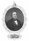
Lewis Cass courtesy of aadl.org
This prejudice against Michigan would take more than a decade to overcome. Lewis Cass was the main architect of reversing the noxious view of
The surveyor chosen for the job was Orange Risdon. Risdon was a major force, along with Samuel Dexter and John Allen, in the development of

Washtenaw Indian Trails
Much of the material in this post was drawn from Fuller, George Newman, “Economic and Social Beginnings of Michigan," Wynkoop, Hallenbeck, Crawford Co, 1916.
The map of Indian trails is from the aadl.org site and taken from Hinsdale, W.B., "The Indians of Washtenaw County, 1927.