
Map catalog adds building outlines based on countywide LiDAR imagery
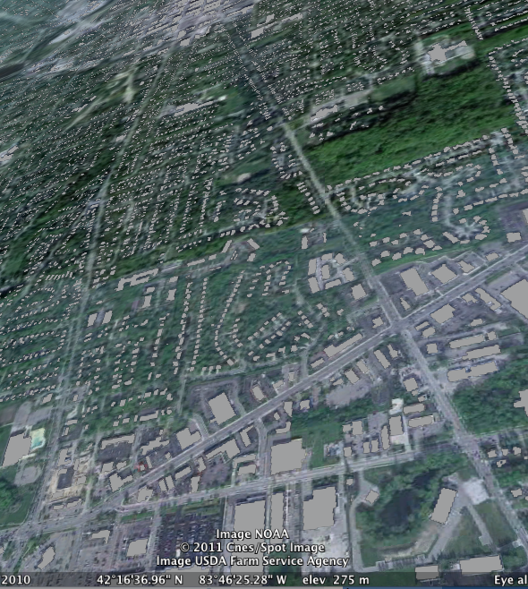
Grey rectangles represent building outlines in this view of Ann Arbor looking downtown from the corner of Jackson and Maple. The building outlines were derived from a digital imaging database that uses LiDAR to produce a precise digital elevation map of the entire county.
Ann Arbor GIS, Google Earth
A new map, Building Footprints, uses digital imaging data to identify the location and size of buildings in the City of Ann Arbor.
I wrote about some of the boundary maps available from this data catalog last year (New data set from city shows free digital maps of Ann Arbor and Washtenaw County, February 19, 2010).
Building footprints
According to the data description for this feed, the City of Ann Arbor built a data file based on 2009 countywide LiDAR imagery. Using a semi-automated method, all buildings over 100 square feet were identified and marked here as a layer seen in grey.
The Building Footprints KML file can be loaded into Google Earth; if you have a GIS system that imports shape files, the Building Footprints shape file is also available.
LiDAR imagery
SEMCOG, the Southeastern Michigan Council of Governments, has a 2010 LiDAR imagery project to collect three dimensional data for Wayne, Washtenaw, Oakland and Macomb counties - a total of 2,351 square miles. The imagery project description (PDF) describes collecting true color plus infrared data, allowing mapping of vegetation, impervious surfaces, and automated feature analysis.
A Washtenaw County request for proposals from 2008, RFP 6408, describes the technical requirements for image gathering.
How do you identify buildings from imagery?
One of the most cited and readable papers that I could find that describes the process of reconstructing building outlines from LiDAR data is "Heuristic filtering and 3d extraction from LiDAR data", a 2002 paper by Abdullatif Alharthy and James Bethel at Purdue University.
The need for a fast, efficient and low cost algorithm for extracting 3D features in urban areas is increasing. Consequently, research in feature extraction has intensified. In this paper we present a new technique to reconstruct buildings and other 3D features in urban areas using LIDAR data only. We have tried to show that dense LIDAR (Light detection and ranging) data is very suitable for 3D reconstruction of urban features such as buildings. This concept is based on local statistical interpretations of fitting surfaces over small windows of LIDAR derived points. The consistency of the data with surfaces determines how they will be modeled. Initially, the data has been filtered to remove extraneous objects such as trees and undesired small features. Then, boundaries will be extracted for each facet using statistical information from the surface fitting procedure, and using inferences about the dominant direction. Building features extracted from actual dense LIDAR collected over the Purdue campus are presented in the paper.
Looking at the description of the algorithm, it's easy to see where it might fail. There is a general assumption that buildings are mostly rectangular, and that they are aligned on a relatively uniform grid. I'll be looking for octagon houses, geodesic domes, and underground bunkers that hide from this relatively efficient large scale building inventory process.
Edward Vielmetti looks at maps for AnnArbor.com. Reach him at EdwardVielmetti@AnnArbor.com.
Comments
Rod Johnson
Thu, Feb 17, 2011 : 8:22 p.m.
They caught the dome shape at (approx.) 1564 Jones Dr.