
The Huron River runs through Ann Arbor in 1819
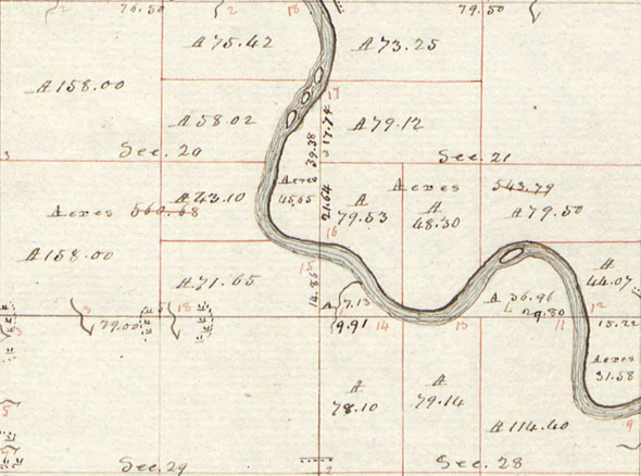
The Huron River flows freely through Ann Arbor in this 1819 survey map. Islands top center are in the middle of what is now Argo Pond; Island Park is visible center right.
Joseph Wampler | Bureau of Land Management
The Bureau of Land Management's General Land Office Records Automation web site has more than 5 million documents of land patents, survey notes, field notes and land status records dating back to 1810. The records are sorted by state and county and are searchable by name.
To do a thorough search for records for this area, it helps to know that Ann Arbor Township is recorded as Town 2 South, Range 6 East, in the Michigan-Toledo Strip meridian.
Links
- Land patents in Ann Arbor Township
- John Allen and Elisha Rumsey's land patent for the south half of section 21, Ann Arbor Township.
Surveying Washtenaw County
Joseph Wampler, working out of the survey office in Chillicothe, Ohio, surveyed Ann Arbor Township in 1819. His work was approved by Edward Tiffin, Surveyor General, on Nov. 5, 1819.
Joseph Wampler (1783-1842) conducted early surveys of Washtenaw County and other counties in southern Michigan. His work was known to be appreciably more accurate than some of his contemporaries, and in some cases he was sent out to resurvey land which the original surveyor had botched. Wamplers Lake in Lenawee County is named after him.
The surveyor's notes on the Ann Arbor Township survey indicate the quality of the land along the survey line. "Rolling land, W & B Oak" is the boundary between section 28 and section 33; that line forms a part of today's Hill Street in Ann Arbor. "Level, thin land, W & B Oak" describes State Street near the University of Michigan campus.
Links
- Survey details, Township 2 South, Range 6 East, Michigan - Toledo Strip (Ann Arbor Township), 1819
- Joseph Wampler, Arborwiki
Map comparison
Almost 200 years of industrial activity has changed how the Huron River looks through Ann Arbor. Here is the Google Map image of the same location.
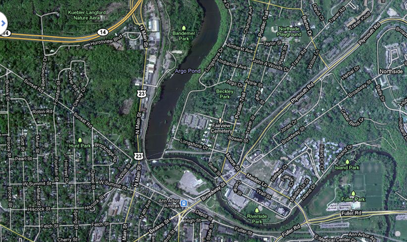
The Huron River runs through Ann Arbor today.
Google Maps
Comments
A2anon
Wed, Mar 2, 2011 : 1:02 a.m.
Wow, great comparison -- love the maps for visualizing the changes. Thanks for that!